So2Sat - 1016 Bytes from Social Media to Earth Observation Satellites
In 2050, it is expected that three fourths of the world’s population will live in metropolises. This transition will inherently alter the physical dimensions and configurations of cities at all scales, which is a fact presenting an enormous challenge to urban planners and logisticians. Yet, our understanding of urbanization at these scales is primarily based on United Nations population figures, but these statistics do not provide information on the distribution, pattern, and evolution of the built environment. For example, the knowledge of the spatial evolution as well as the posulation density of informal settlements such as slums or refugee settlements in many mega-cities is far from sufficient for a sustainable planning.
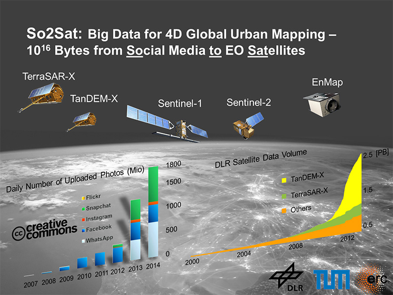
Such sustainable planning requires data which has been hard to obtain in the past. So2Sat is an ambitious European Research Council (ERC) starting grant project. In the project, we will use revolutionary mapmaking methods to close these knowledge gaps and investigate how human settlements grow in global scale. We have the privilege to access the data supplied by several German and European earth observation satellites, such as TanDEM-X and EnMAP, which are equipped with innovative sensor technologies. We will develop new algorithms for the derivation of geo-information from these measurements. This makes it possible to create high-resolution 3D/4D maps of the cities up to individual building. For the first time, this information will also be combined with data from social media: crowdsourcing platforms such as OpenStreetMap providing up-to-date map material; photos posted to the social media providing authentic and current images where building facades can be seen with much higher resolution than the earth observation data or where, for example, the extent of damage caused by a natural disaster can be revealed. The major challenge here is consolidating this information and evaluating it automatically in a global scale.
By exploiting the recent advances in signal processing and computer vision, the aim of So2Sat is to - for the first time - systematically fuse the remote sensing data acquired by sensors mounted on diverse platforms, in particular from Earth observation satellites, with the massive data available from GIS and social media to map 3D urban infrastructures and their evolution over time, i.e. 4D, in high resolution and on a global scale.
The outcome of this project will be a first and unique global and consistent 3D/4D spatial data set on the urban morphology of settlements, and a multidisciplinary application derivate assessing population density. This is seen as a giant leap for urban geography research as well as for formation of opinions for stakeholders based on resilient data.
![]()
![]()
![]()